One of my favourite types of bushwalking is walking along sea cliffs – I just love peering out of the bush and looking down on that beautiful blue water that disappears into the distance, and seeing the colour of the raw rock of the cliffs against the sea! Southern Tasmania abounds with sea cliffs – some of the highest in the southern hemisphere are down here.
I’ve just walked along the Alum Cliffs, on the Derwent River just south of Hobart, Tasmania’s capital city, and they meet my expectations!
The Alum Cliffs are only about 100 metres high, nothing like the much higher cliffs on the Tasman peninsula 100 kilometres away, or the ones on the southern end of nearby Bruny Island. But the Alum Cliffs are only a half-hour drive away from Hobart on the way to Kingston, which makes them very accessible.
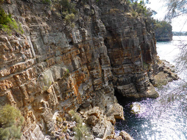
So how good are these accessible cliffs? Well they are beautiful and dramatic, as good sea cliffs should be, as you can see from these pictures:
The walking track
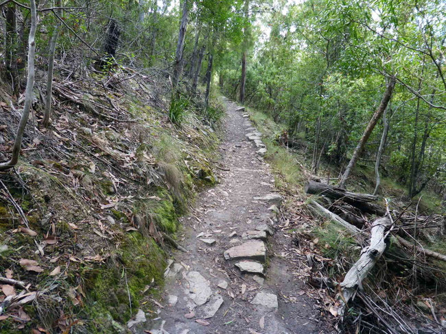
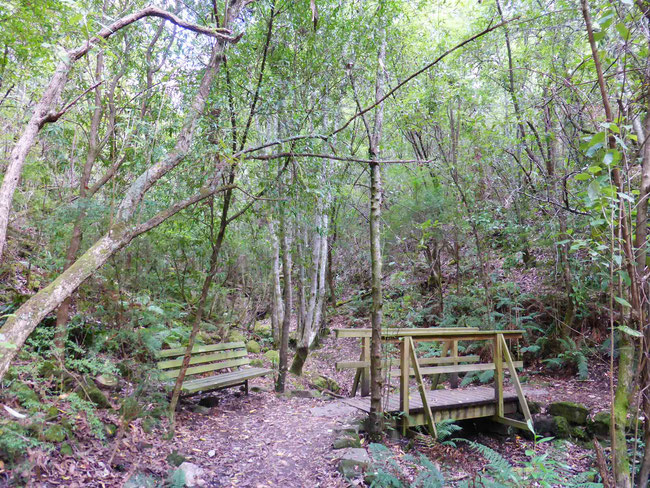
The walking track is a bush track, but it’s clearly defined and quite trafficable, as you can see here:
Most of the way the path is set back from the cliff edges, and you are looking out to sea through the bush, like this:
This sort of view is very picturesque, but it’s also nice to be able to get a full and clear view – there are a couple of lookouts along the path with safety barriers at the cliff edge that allow this. There are also a few ‘unofficial’ tracks running off the main track the lead right to the cliff edge. I used these to see and photograph some of the best views.
Of course there is a risk in doing this. If you are walking on cliff tops you must remember that the reason that there is a cliff there is because the land is being eroded away, and is therefore unstable. The cliff edges can be very weak and crumbly and can undercut by the sea waves, making the edges unreliable. Someone fell off these cliffs just last year – so if you go on this walk and you follow my lead here, or go close to the edge on any cliff walks, be careful!
Another great way to see these cliffs would be from the water in a kayak, which is something I hope to do someday not too far into the future!
The scenery
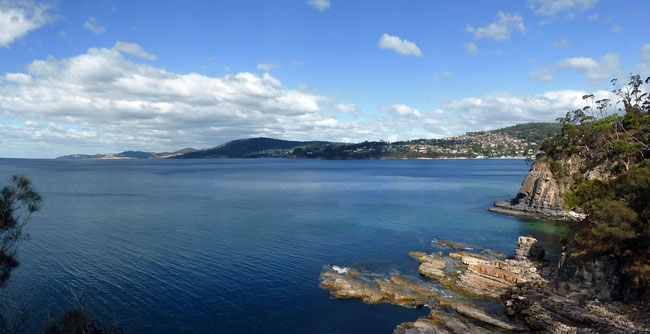
Some the best scenery is at the southern end of the route, near Kingston Beach. This is the view from one of the headlands looking back towards Kingston – look at that beautiful clear, still blue water!
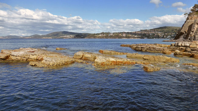
Here’s a closer view of some of those rocks and the clear water that surrounds them:
And here are the rocky edges of the headland dipping down into the water:
Here’s a pretty little bay set into the headland:
At one point the track crosses a rainforest gully, which is a very different environment to the dry eucalypt forest of the rest of the route. The creek crossing at the bottom the gully is a cool, moist, mossy place.
The “river”
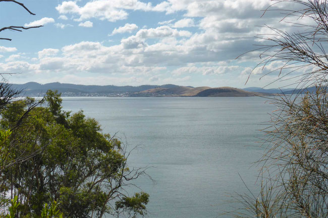
This is the view from the top of the Alum Cliffs looking across the Derwent River to Tranmere peninsula on the opposite side:
Now, you may be impressed by the width of that river – it’s over four kilometres across at this point – but personally I don’t think it should be called a river here. This body of water is really part of Storm Bay, which is an inlet of the Southern Ocean. I think the Derwent River really ends between Macquarie Point and Rosny, near Hobart, just downstream from the Tasman Bridge – but that’s just my opinion, the Derwent River it is!
Doing the walk
You can start this walk from either end – there’s parking and access, and even somewhere for a cup of coffee at each end. I started at the northern end simply because that’s the end you get to first if you are coming from Hobart, which most travellers are.
If I do it again, which I probably will, I will start at the southern end, at Kingston Beach. This is because the first few hundred metres from the northern end are a steep descent into a gully, and a steep climb back out of the gully up to the back of the cliffs. There are 120 steep steps going down, and 75 steep steps climbing back up, all in an uninteresting environment. If you start at this end the last part of your return journey will be climbing back up those 120 steep steps! Here’s what they look like:
Note the seat for taking a rest on the way back up.
If you are coming from the southern end, as you will if you follow my advice, you will know when you are at the end of your walk when you see this distinctive picnic table and the sign behind it directing you to the Shot Tower:
Time to turn back!
My route
This is the route I took, shown on a Google Earth aerial view:
This route includes both my outward and return journeys. You can see where I looped out closer to the cliff edge on my outward journey in a couple of places to get a better view. These loops aren’t the official route, although mostly the tracks I took are still very clear because other people also went there to get a better view.
My walk was about seven kilometres and took me two-and-a-half hours.
More information about the Alum Cliffs track
You can find out more information about this walk here on the Greater Hobart Trails website (which should really be called Greater Hobart Tracks), such as starting and ending points.
You can also download a GPX file from this website to use with your GPS unit or GPS phone app, although you don’t really need one as the track is very clear.
You can see the route that I took (more or less) on Google Maps here.
That's it! If you go on this walk, let me know what you thought of it below in the comments!
Would you like to add something, or ask a question? Add a comment below (you can leave the 'Website' field blank):


