The Tasman Bridge is a graceful bridge that spans the Derwent River, joining Hobart city to the suburbs on the eastern side of the river, to the airport, and to the south-east of Tasmania in general.
The Tasman Bridge was built in 1964 so it’s over fifty years old, but it’s such a modern-looking bridge that it’s hard to believe that it’s as old as it is; certainly, it’s a surprise to see old photos of it covered in 1960s Australian cars, and it’s a surprise to see its original construction cost listed in £s (Pounds), as it was constructed before Australian Dollars came into existence.
But, regardless of the Tasman Bridge’s grace and style, it has a chequered history: it was involved in a serious maritime disaster. If you are in Hobart for long enough you are going to have to hear about, and consider, the story of the Tasman Bridge Disaster.
The modern-day Tasman Bridge
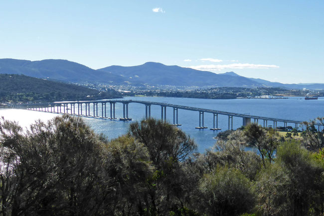
Here’s a picture of the Tasman Bridge, as you see it from nearby Rosny Hill lookout:
If you look carefully you will see that there is an inconsistency in its design. Spotted it?
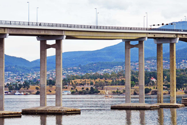
Except for the obviously different, but still symmetrical, gaps between the larger pylons in the centre of the bridge, which is where the shipping channel is, the gaps between adjacent pylons are similar and symmetrical about the centre of the bridge – except for a larger gap between two of the pylons at the eastern end (on the right) of the bridge. Here’s that gap:
The disaster
That larger gap wasn’t always there. In 1975, eleven years after the bridge was completed, the MV Lake Illawarra, a bulk carrier ship carrying a load of 10,000 tonnes of zinc ore concentrate, was approaching the bridge and lost control in strong tidal currents and tried to pass between the wrong pair of adjacent pylons in desperation. In doing so it hit two of the pylons and knocked them down with the adjacent spans of roadway.
Amazingly, no cars were on the collapsing section, but four cars went off the ends of the bridge. Another car was able to stop just in time with its front wheels hanging over into free space, and another car stopped just before the edge and was hit by a following car, pushing its front wheels over the edge! A bus full of people was only just able to stop in time before going over, too. The pictures of the two cars hanging over the edge became famous; you can see one of the pictures here on the Australian Broadcasting Commission (ABC) website.
The collapsing roadway fell on to the ship, sinking it.
Twelve people died in the disaster: seven on the ship and five in the cars that plunged off the bridge.
The reconstruction
The ship and the debris from the bridge were too hard to clear up to enable the replacement of the destroyed pylons, so the adjacent pylons were strengthened and a longer, stronger span was added, resulting in the inconsistent appearance of the modern bridge.
The MV Lake Illawarra now lies across this longer span, just south of the bridge and partially under it. I visited the Maritime Museum in the city recently; they have a model that shows just where it and the bridge debris are.
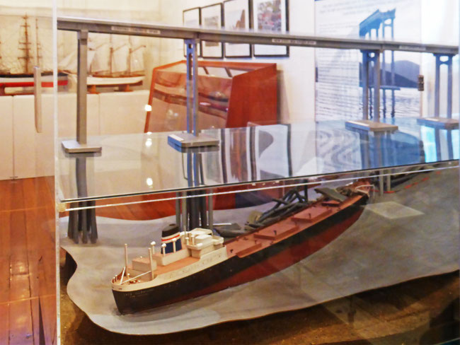
It’s interesting to note that the Tasman Bridge cost £7,000,000 to build (this was before Australia’s currency was changed to dollars) and eleven years later it cost £22,000,000 (AU$44,000,000) to repair.
Seeing the MV Lake Illawarra
I wonder if, when a big tide was in bringing clearer water from the sea, and the weather was calm so there were no ripples on the surface, and there was a clear sky so the reflections on the water were minimised, and the sunlight was striking at just the right angle to pass under the bridge and illuminate the wreck, you could see the wreck (and photograph it) from the bridge? I'll keep my eyes open for these circumstances coinciding – but I doubt that I'll be lucky enough to be in the right place at the right time for it!
The disaster memorial
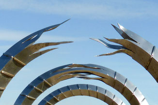
There’s a memorial for the disaster and the rebuilding of the bridge at nearby Montagu Bay. It's in the form of a sculpture called Impact.
The three circles represent the bridge torn apart, and then progressively rejoined, a process that took two-and-half years. If you line up the three circles, as they are in my photo, you will find that they focus on the part of the bridge that was hit by the MV Lake Illawara.
Ships under the bridge
Nowadays, ships passing under the bridge are guided by laser leading lights and have modern navigation equipment to assist, as well as always having a pilot on board, and really big ones have attendant tugs ready to take over control, if necessary. And I’m sure their commanders have a sobering knowledge of the history of the bridge to keep them focussed. But, just in case, traffic over the bridge is stopped while any big ships go through.
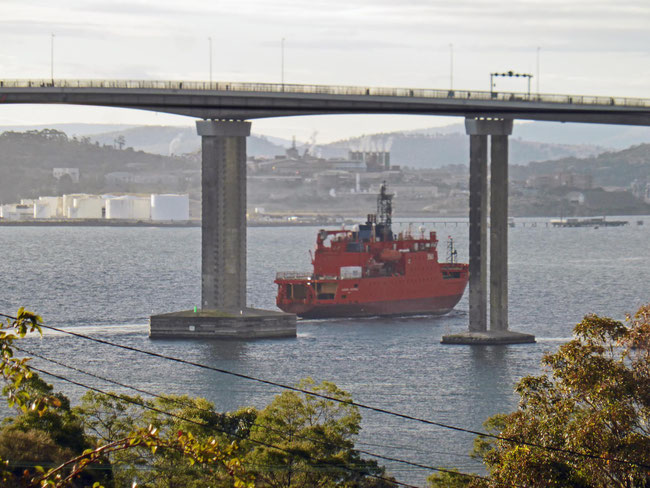
I watched the Aurora Australis, Australia’s ice breaker that supports our Antarctic activities, go under the Tasman Bridge from the veranda of our Rosny house-sit; here it is just after it passed under the bridge:
The old bridge
The bridge that the Tasman Bridge replaced is also worthy of mention: It was a floating bridge nearly a kilometre long, and comprised of a series of pontoons anchored in the river, which were attached to a short fixed section at the western end that had a raisable roadway to allow ships to pass through. This bridge was no wobbly pontoon dock: it carried a high volume of traffic, and had a footpath and streetlights. It was in use for over twenty years.
You can read more about the Tasman Bridge disaster here, on Wikipedia.
Share this The Journey and the Destination post using your favourite social media:
Would you like to add something, or ask a question? Add a comment below (you can leave the 'Website' field blank):


Chris (The Journey and the Destination) (Friday, 16 October 2020 13:06)
Hi Rowan,
Yes, I think I've got a polarising filter tucked away somewhere. If I can find it I may give it a go next time I get down to Hobart. Thanks for the suggestion.
Rowan Eisner (Thursday, 15 October 2020 02:27)
You could use polarising lenses to cut reflection to photograph the wreck.