I grew up in sub-tropical south-east Queensland, where there's not a lot of snow, so snow is something of a miracle to me – it's like it's out of a fairy tale. I've been hoping to get to do some bushwalking in snow before this winter is over. I have returned to Tasmania in the early spring, and there's still quite a bit of snow around at high altitudes, so this is my big chance to fulfil that dream.
Hartz Peak
My Tasmanian-bushwalking mate Denis recommended nearby Hartz Peak, so we set off to climb it. Hartz Peak can be seen from the southern Huon Valley. Here is its snowy peak, as seen from Port Huon:
I've been part of the way on this walk before when I walked to nearby Lake Esperance. This part of the walk is across a high plateau covered in Alpine heath. There’s a lot of water moving through up there, and the Tasmania Parks and Wildlife Service has built raised walkways through the alpine wetlands to make the walking much easier and to minimise the environmental damage done by walkers.
There are many tarns on the plateau. (Tarns are pools of water that collect in depressions left by glaciers thousands of years ago.) This is a misty view of Ladies Tarn, with some snow-capped hills behind it, showing through the mist.
Here's another little tarn, with Hartz Peak and Mount Snowy rising from behind it.
The snow
There had been small patches of snow beside the path as we crossed the alpine plateau; but we really hit the snow when we climbed up to a saddle on the ridge that leads to Hartz Peak – the climb is straight up a steep snowy embankment!
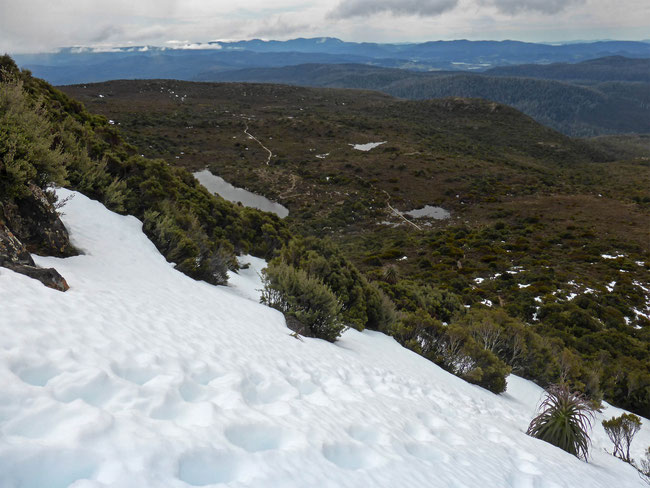
Here’s the view looking back down from high up on the snow embankment to the plateau below, just visible through the fog:
Here am I coming up the snow embankment, enjoying every moment of this new experience!
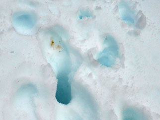
While the snow looks solid to walk on, in places it’s hollowed out underneath by flowing melt water. When you walk on those areas you can go straight through, usually just to your knees, but sometimes you go in thigh deep! Even though the snow doesn’t have much strength, it’s surprisingly hard to extricate yourself when this happens.
By the time we got to the top of the ridge the mist had cleared and we could look back at the path across the plateau, weaving between little tarns.
The Tasmania Parks and Wildlife Service has put a lot lot of work in up here on the pass building the path. Here, heavy pieces of rock have been rearranged to make a fairly even path along the ridge towards Hartz Peak.
The wind across the pass was blowing so hard, and was so turbulent, that we had trouble staying on this path.
The views from Hartz Peak
When we got up the ridge the misty sky cleared, the views opened out, and we could see a great distance in all directions.
This is the view looking back towards the east, past the adjacent Mount Snowy and across the D’Entrecasteaux Channel, to Bruny Island on the horizon:
This is the view looking south past Mount Snowy:
Almost to the top now; this is Hartz Lake:
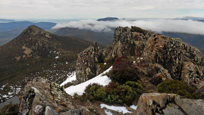
This is the view from the top of Hartz Peak. Someone has built a sheltering wall to hide behind while taking in the scenery; the wall is reminiscent of the beehive huts on Skellig Michael island in Ireland:
We had planned to continue along the ridge to Mount Snowy, but the wind was blowing so hard that it was difficult to keep on the narrow tracks, and the track to Mount Snowy is exposed on the windward side of the Ridge, so we decided not to go the last bit. Here's a little bit of video I took while I was up the top; it gives a good feel of the weather conditions up there – watch for the bushes blowing in the wind to give you an idea of how strong the wind was!
The walk
Our walk to the top of Hartz Peak was 7.6 kilometres return from the car park. The walk, including stopping for lunch and the view, took around four hours. The summit of Hartz Peak is 1223 metres high. We climbed a total of 406 metres. Here’s a Google Earth aerial view of our route:
Hartz Peak is in the Hartz Mountains National Park. If you want to do this walk, you can get more information about it from the Parks and Wildlife Service website, here, and from their brochure, here. To enter the park you’ll need to get a park pass, which you can find out about here.
The walk starts at the car park at the end of Hartz Road, here (on Google Maps). The track is marked by signs, and a lot of it is constructed anyway, so you can’t miss it; although, the final climb is not so obvious, especially when it’s under snow. The track is poorly marked on Google Maps; but you can also download my KML file for your GPS app or GPS unit here, to help you to find your way.
Tags
If you enjoyed this blog post, you can find related posts under these headings:
Share this The Journey and the Destination post using your favourite social media:
Would you like to add something, or ask a question? Add a comment below (you can leave the 'Website' field blank):


