Our house-sit in Augusta is only a few kilometres from Cape Leeuwin, which is the south-west-most point of Australia. It's a wild place at the junction of the Indian and Southern Oceans.
As an east-coast Australian, I grew up with the dominating presence of the Pacific Ocean; I haven’t seen much of the Indian Ocean, so it’s exciting to be visiting its shoreline!
Cape Leeuwin is the starting (or ending) point for the Cape to Cape Walk Track, which runs for 135 kilometres between Cape Naturaliste lighthouse and Cape Leeuwin lighthouse. Today we did the first two and a half kilometres of this walk! Half of our walk was along the coastline, and the other half was climbing up onto the adjacent ridge to a lookout over Skippy Rock.
This whole area is heavily imbued with limestone, with a huge limestone ridge running virtually from one cape the other. Limestone geology always creates interesting landscape features, because the ground water running through the limestone becomes saturated with dissolved lime and, as it runs over or drips off anything, it evaporates and leaves behind lime as a new deposit of solid limestone.
The Cape Leeuwin Lighthouse waterwheel
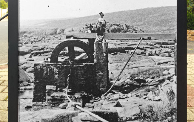
Our walk started near an historic water wheel that was used to collect and pump water to the nearby Cape Leeuwin Lighthouse. Over the more than 130 years of its existence, the lime has encased the water wheel as the water has run over it and dripped off it.
Here’s a picture, which I found on the side of a rubbish bin in downtown Augusta, which shows the water wheel in operation, before the lime encased it:
This is the view back to the Cape Leeuwin lighthouse, just after we left the water wheel:
Limestone formations
Lime-saturated ground water also created another of the interesting features that we saw on this walk. This cliff has long had water from a spring running over it:
The precipitating lime from the water leaves strange tiered shapes on the cliff face. The grey areas are where the limestone has dried out, but the ochre-coloured areas are still wet and dripping. Here’s a closer view of the limestone formations:
In some places the water creates dripping, lipped orifices worthy of the works of Brett Whitely or Patricia Piccinini:
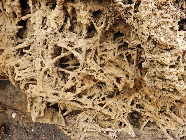
At another location on the cliff the lime appears to have precipitated while running through channels in sand, after which unaffected sand was washed away leaving what look like a tangle of limestone straws (that’s my guess, anyway):
The granite
The limestone is underpinned by granite, which is exposed in many places. The granite gets colonised by lichens, some of which are bright orange. This is the view looking north from near the beginning of our walk, with a mixture of bare granite and limestone:
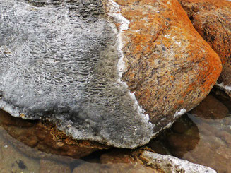
Here’s an interesting small patch of lichen on a granite boulder:
Here’s a nice granite outcrop:
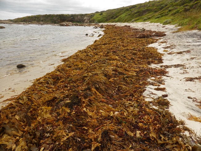
Even though the water is much warmer than it is in Tasmania (not that I’ve been in it yet), there is still plenty of seaweed here, although none of the giant kelp that I have seen all the time in southern Tasmania. Here the seaweed that has been dislodged by wild weather has been concentrated on one of the beaches that we walked along:
Skippy Rock lookout
After we left the coast to climb up the coastal ridge we walked through coastal heath a couple of metres tall, which only gave limited views until we reached the lookout, from where we could see the coastline running north beyond the lookout:
I have no idea what this creature is, but it paid us a visit while we were sitting on a bench at the lookout, eating our lunch!
This beautiful and interesting coastline seems like it goes on forever, and we’ll be exploring lots of it while we’re house-sitting here!
Tags
If you enjoyed this blog post, you can find related posts under these headings:
Share this The Journey and the Destination post using your favourite social media:
Would you like to add something, or ask a question? Add a comment below (you can leave the 'Website' field blank):


