Our house sit is near the southern end of the Cape to Cape Track, a well know walking path which runs for 135 kilometres between the lighthouse on Cape Naturaliste and the lighthouse on Cape Leeuwin, in south-west Western Australia. Many people walk this track, usually over about seven days. We aren’t planning on doing this, but there is access all along the track, and we have sampled it at many places along its length while we’ve been staying here.
The coastline here is always beautiful, but our most recent meetings with the Cape to Cape Track has proved to be exceptional, with breathtaking views of the sea at every step and wonderful geological structures along the way. This is the section from Conto Spring to Bob’s Hollow.
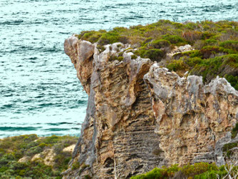
It’s a relatively short walk of 7.5 kilometres return. Most of the walk is along the top of limestone cliffs up to 100 metres high. Here are the cliffs as seem from Conto Spring, a beach-side camping area near a natural spring:
This is a close up of the main part of the cliffs, with spray from the breaking surf blowing in:
This is the view from the top of those cliffs, looking south back to Conto Spring:
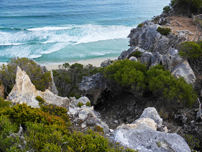
This is the view looking down from the top of the cliff face to the sea and beach below:
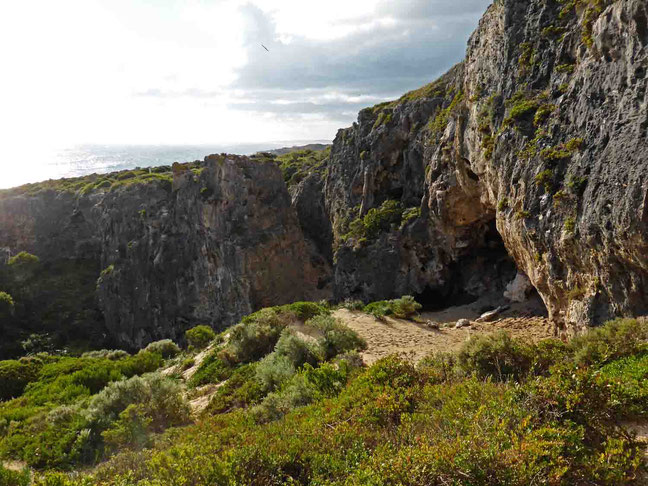
This is the view from further along the walk, looking north towards Bob’s Hollow along a curve of limestone cliffs:
This is the view looking back south towards Conto Spring, now in the distance, with some of the limestone cliffs visible:
The walking track
This part of the cape to Cape track is mostly a narrow, sandy, dirt track that cuts through the low bright-green coastal heath, with some sections of the path up and down the cliff faces. Just about every point on the route has excellent views of the sea and the coast.
Unlike other sections of the Cape to Cape path, in which the coastal heath is higher than your head limiting your view, the heath in this section is usually at chest height or less, due to its exposure to the winds. The low heath is very dense, and pushing through it without a path would be very tiring!
While most of the track is a sandy dirt path, occasionally outcrops of the underlying limestone, which have to be picked through, obstructed it:
As is usual with limestone, it forms interesting and even fantastic shape; this one looks like an abstracted representation of a pelvic bone that Henry Moore may have designed!
All along of this section of coast there are limestone reefs formed from ancient shorelines. These reefs make great surf breaks:
Here’s an intriguing side path that runs through a narrow chasm in the cliff face:
Limestone cliffs
The limestone cliffs are eroded and pocked with small caves. All along these cliffs these are signs of their continual collapse as they erode.
Bob’s Hollow
Our destination, Bob’s Hollow, is a small and picturesque bay. The cliffs that define most of Bob’s Hollow are the usual limestone. This is the view of Bob’s Hollow from the top of the limestone cliffs:
You can see a large boulder of limestone in the foreground that has separated from the cliff face.
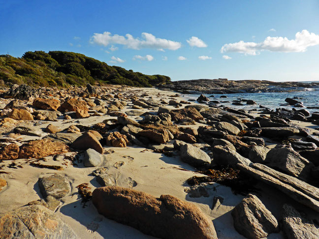
The headland that defines the southern end of Bob’s Hollow is much harder gneiss, which forms rounded boulder as it erodes, rather than the sharp-edged rock masses that result from the eroding and dissolving limestone.
Waves breaking over the rocks of the headland reveal the clear, turquoise water of the Indian Ocean:
The walk
This is a very enjoyable walk due to the excellent views at all points, the beautiful bright-green coastal-heath vegetation, and the dramatic limestone sea cliffs.
We started our walk where the Cape to Cape Track crosses the access road to Conto Springs. You could start the walk at the Conto Spring carpark, walk along the beach a little, and climb up a track up the cliff face. We parked our car here.
This is our route, captured on my phone using the Handy GPS app, shown on a Google Maps aerial view:
You can see my route, and download a kml file to use in your GPS navigator or navigator app here.
If you are after a slightly longer walk, I believe that you could enjoyably extend this walk north along the Cape to Cape Track at least a further two or three kilometres to the next beach; but of course, you could go all the way to Cape Naturaliste and enjoy it, too!
Tags
If you enjoyed this blog post, you can find related posts under these headings:
Share this The Journey and the Destination post using your favourite social media:
Would you like to add something, or ask a question? Add a comment below (you can leave the 'Website' field blank):


