Bushwalking
I love going bushwalking (also known as trekking, walking, and hiking, but bushwalking in Australia). On a bushwalk you get to experience the essence of a place, and get some (probably imaginary) idea of what a place would be like without human interference, or, at least without immediate human domination.
Sometimes it’s hard to draw the line that separates bushwalking from just visiting a place on foot. Maybe the walking needs to be off tracks (trails, paths) that are made for the particular purpose of walking, and maybe the walking needs to be through wilderness (whatever that is), and maybe the walking needs to include camping out overnight, and maybe the navigation needs to be more than just following the signs, for it to be 'real' bushwalking.
But I’m not going to be too hard about the definition of bushwalking here! These bushwalks range from very easy to quite hard, with navigation ranging from very minimal to reasonably complex, and, as yet, none are overnight. Mainly, I try to make sure that they are through interesting territory with nice scenery, and that they are enjoyable – so please enjoy them!
And talking of navigation: most of my pre-walk navigation planning these days is done using Google Earth, and my navigation on the ground is done using Handy GPS on my phone. Read my blog about Handy GPS – it’s an immensely useful app for bushwalking, and any walking while travelling, as well as for keeping records of your walks.
Time for a new daypack

I've had my hardworking Deuter Gogo daypack for three years now, and after much use all over Australia, Europe, and New Zealand it’s getting very worn – the main compartment zip has broken and it’s got a few holes in it – so the time has come to replace it. When I’m traveling I use my daypack a lot; I usually have it on every day so to get one that is close to perfect for my purposes is important, and I put some effort into choosing one.
A visit to Bribie Island

Bribie Island is a sand-barrier island that runs for over thirty kilometres south from Caloundra, where I’m staying.
The southern end of the island is quite developed, but the northern end near Caloundra is natural and wild, so it’s an attractive place to visit as a contrast with the highly urban development of Caloundra.
Currimundi beach wildlife

I like long walks on beaches, and there’s a long beach that runs north from Moffat Beach on the Caloundra Headland, near to where I’m staying.
Apart from the general beauty of the beach, there’s commonly some interesting and unusual wildlife to be seen here.For this particular walk some small pelagic animals that I rarely, if ever, see had been blown in by the wind.
Bushwalking in Como, Italy

We are in Como in northern Italy for a few days between housesits. The people we are next housesitting for in Castronno told us about a great bushwalk in the mountains around Como, so we decided to walk it while we are here.
The walk runs along a high ridge above the shore of Lake Como, with great views of the lake and its surrounding towns.
The Blue Mountains
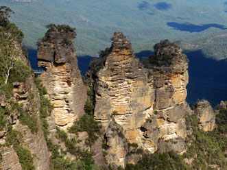
Sydney is surrounded, even enclosed, by a vast area of mountainous wilderness. This wilderness is divided into several national parks, the best known of which is the Blue Mountains.
I've flown over the Blue Mountains many times, usually coming in to or leaving from Sydney. I've always been impressed with this expanse of rugged mountains, bush, steep cliffs, and deep canyons, that’s so close to a big city, and I’ve always harboured the idea of visiting and bushwalking in some of this amazing environment.
Walking on a foggy Kunanyi
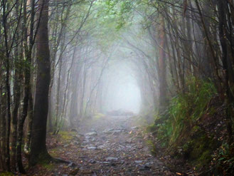
Kunanyi/Mt Wellington is a big part of the soul of Hobart – It’s 1270 metres high, and only eight kilometres from the centre of the city, so it looms over the city, and is visible from just about any part of it.
Our house-sit in Lenah Valley is right under the mountain, so we came up with the idea of travelling to the top (there’s a road right up to the pinnacle) and walking back down through the bush to our house-sit.
A day in Tasmania’s Liffey Valley
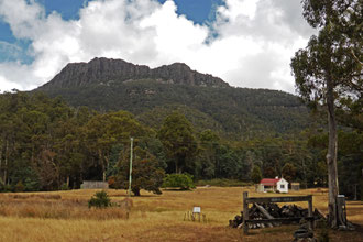
Local markets are one of our favourite ways of interacting with local people as we travel around house-sitting. Yesterday we visited the Liffey Valley Markets in northern Tasmania. To complement our trip to the markets, we had a look to see what else was in the area, and we found that there are some bushland reserves that looked worth a visit.
It turned out to be a great day with lovely experiences and beautiful Tasmanian rural and bush scenery.
Rocky Cape National Park
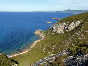
As with most travel destinations, visitors to Tasmania, especially those who are on a tight time budget, head for the well-known attractions such as Cradle Mountain, Freycinet National Park (including Wine Glass Bay), and Maria Island. These are top places on the typical traveller’s ‘must do’ list for good reasons – they are all beautiful places that you actually should see.
Of course, Tasmania has many more beautiful places on offer that are also very much worth visiting – one of my favourites of these is Rocky Cape National Park.
Climbing Mount Barrow
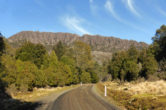
Mount Barrow is one of three large mountains east of Launceston, which can be seen from all over the city. (The others are Mount Arthur and Ben Lomond.)
Mount Barrow is an alpine plateau about 4 kilometres long, with two main summits: Mount Barrow itself, and South Barrow.
I’ve recently climbed Mount Barrow, and explored its alpine plateau.
Climbing Mount Arthur
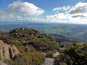
Mount Arthur is one of several high mountains near Launceston, in northern Tasmania, which I've mentioned in a previous post. I've been thinking about climbing Mount Arthur for a long time, since my house-sit here two years ago; and this time I've got around to doing it.
You can see Mt Arthur from all around Launceston, so I knew from regular observation that it commonly has its head in the clouds.
Walking the South Esk track
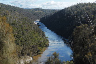
I've bushwalked on the Trevallyn Nature Recreation Area, near the Launceston CBD, many times while house-sitting here.
I thought that I’d pretty much covered all of it; however, I've realised recently that there is one bit of track there I may have never walked on. That track is the South Esk track, which runs along Cataract Gorge, above the South Esk River.
A pastoral walk in northern Tasmania
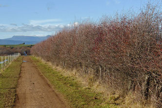
18th-century Britain’s answer to America’s slave trade was convict transportation, and Tasmania has a substantial convict history – convict labour built much of the early infrastructure here.
During Australia's convict period the colonial governments allocated convicts as free labour to landholders, allowing them to develop their estates to become substantial and impressive.
A walk to Bob’s Hollow
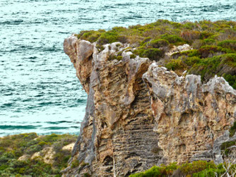
Our house sit is near the southern end of the Cape to Cape Track, a well know walking path which runs for 135 kilometres between the lighthouse on Cape Naturaliste and the lighthouse on Cape Leeuwin, in south-west Western Australia. Many people walk this track, usually over about seven days. We aren’t planning on doing this, but there is access all along the track, and we have sampled it at many places along its length while we’ve been staying here.
Seeking big trees in S-W WA

South-west Western Australia has a long association with the timber industry. Before the European invasion this corner of Australia was covered in a huge ancient forest of Karri, Marri, and Jarrah trees. Timber was being cut here 130 years ago and exported all over the world. As is usual with the timber industry, the cutting was rapacious and pretty much all of it was cut down.
We’ve done a walk through Boranup Karri Forest near here, but it’s only re-growth forest (although, at 130 years old, the trees have made it to a good size); so we decided to head out to find some real old-growth forest.
Walking at Cape Leeuwin
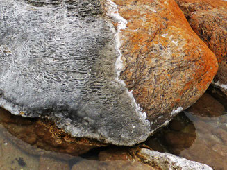
Our house-sit in Augusta is only a few kilometres from Cape Leeuwin, which is the south-west-most point of Australia. It's a wild place at the junction of the Indian and Southern Oceans.
As an east-coast Australian, I grew up with the dominating presence of the Pacific Ocean; I haven’t seen much of the Indian Ocean, so it’s exciting to be visiting its shoreline!
Boranup Gallery’s timber furniture
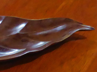
I'm house-sitting in Augusta in south-west Western Australia. This time we are looking after couple of dogs, a cat, and a couple of galahs (large Australian parrots).
We were in this area twenty years ago, so we're following up on some of the attractions that we saw back then. One of those attractions is Boranup Gallery, which exhibits handmade timber furniture mostly made from local Western Australian timbers jarrah, karri, and marri.
A visit to Ben Lomond
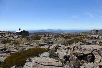
We visited Ben Lomond today, just outside of Launceston. Ben Lomond is one of three large mountain that we see in the view from our house-sit at Trevallyn.
The weather was perfect, and the scenery was dramatic and beautiful with views of the many mountains to the east, the Central Highlands to the west, and Bass Strait to the north.
Climbing Mount Cygnet
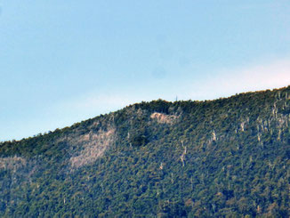
I'm house-sitting in Cygnet, Tasmania, again. This time I'm on the hills looking across Port Cygnet and the inlet. The dominant feature of my view is Mount Cygnet, the summit of a long mountain ridge. You can see Mount Cygnet from all around this area, so, by implication, the view from the top should be extensive. I’ve been eying Mount Cygnet off as a bushwalking destination for a while during my various house-sits here in Cygnet, and I’ve recently worked out how to do it!
Bushwalking in the snow!
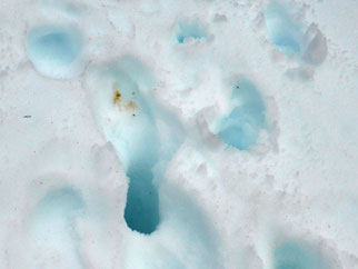
I grew up in sub-tropical south-east Queensland, where there's not a lot of snow, so snow is something of a miracle to me – it's like it's out of a fairy tale. I've been hoping to get to do some bushwalking in snow before this winter is over. I have returned to Tasmania in the early spring, and there's still quite a bit of snow around at high altitudes, so this is my big chance to fulfil that dream.
Walking to Mt Ainslie and Mt Majura
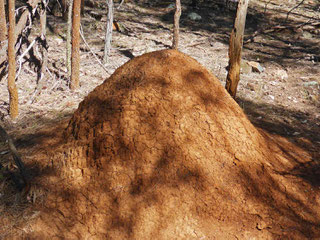
Canberra is a totally planned city designed by the landscape architect Walter Burley Griffin. Before the city was built the area where it now stands was mostly two large sheep stations, Yarralumla and Duntroon. This blank canvas enabled Canberra to be designed with areas of open country, which results in a spread-out city with integrated areas of bushland. This is ideal for urban bushwalking, and means that I can go on a nice bushwalk straight from my front door!
Climbing Platform Peak, Tasmania
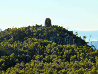
My current house sit in Bridgewater, southern Tasmania, has put me in an area with some great bushwalking opportunities. One of these opportunities is Platform Peak, just outside of the nearby town of New Norfolk.
The walk to platform Peak is through forestry reserve land, which means that it is public land with a low level of environmental protection (it could be logged one day) and minimal walking facilities, such as maintained tracks and sign posting. This means that more care in planning and execution is required, compared with walking in a national park.
Cornelian Bay boat sheds
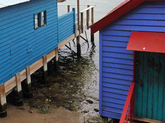
Cornelian Bay is on the Derwent River, just upstream from Hobart and the Tasman Bridge.
There’s a walking path to Cornelian Bay along the foreshore of the river, which runs from the Royal Tasmanian Botanical Gardens. It’s quite a short and easy walk of about five kilometres return.
For the most part the walk is enjoyable but unexceptional – the views are quite urban and even industrial, but nevertheless pleasant and worth seeing. But this little walk does have its special point of interest: a collection of cute boatsheds that step out into the water!
Walking the Alum Cliffs track

One of my favourite types of bushwalking is walking along sea cliffs – I just love peering out of the bush and looking down on that beautiful blue water that disappears into the distance, and seeing the colour of the raw rock of the cliffs against the sea! Southern Tasmania abounds with sea cliffs – some of the highest in the southern hemisphere are down here.
I’ve just walked along the Alum Cliffs, on the Derwent River just south of Hobart, Tasmania’s capital city, and they meet my expectations!
Navigating the wilderness – Handy GPS
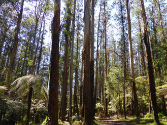
Many travellers are focussed on visiting cities and towns; but visiting wild places is also an important part of travelling. An important part of visiting wild places is ensuring that you know exactly where you are, so that you can get to where you want to go, and are able to get back afterwards. While paper maps are pretty useful for this, the modern method is to use a navigation app on a mobile device. So just what can a navigation app do, and what’s a good app for bushwalking navigation?
