Kunanyi/Mt Wellington is a big part of the soul of Hobart – It’s 1270 metres high, and only eight kilometres from the centre of the city, so it looms over the city, and is visible from just about any part of it.
Our house-sit in Lenah Valley is right under the mountain, so we came up with the idea of travelling to the top (there’s a road right up to the pinnacle) and walking back down through the bush to our house-sit.
This is the view of kunanyi/Mt Wellington and Mt Arthur from the backyard of our house-sit:
The height of the mountain, the close surrounding mountains, the complex adjacent coastline, and the proximity of the city means that the views from the top can be spectacular. However, the escarpment that faces Hobart city also faces the sea, so the mountain is commonly shrouded in cloud, meaning no view at all.
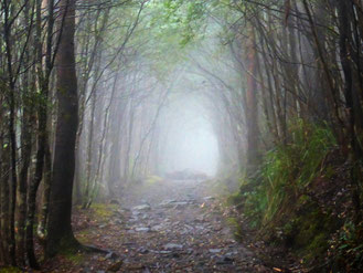
We’re coming to the end of this house sit and we still haven’t fulfilled this plan, and now the weather is looking poor for the rest of the days that we have available and the mountain is stuck in the clouds. We decided to reduce our plans by catching a public bus as far up the mountain as we can, then walking up to a track head called The Springs, and walking down to our house-sit from there. We knew we wouldn’t see the usual spectacular views that this walk provides, but we really wanted to do this walk, and we expected that walking through the forest in the fog would be a lovely experience in its own right.
We caught the bus to Ferntree, at 430 metres ASL (above sea level), and walked up Reid’s Track, a quite steep and rocky path through lovely wet forest, to The Springs. As we went up the atmosphere got foggier and foggier as we rose into the clouds.
When we got to The Springs, at 720 metres ASL, visibility was down to about 100 metres.
We have a great coffee and cake at Lost Cargo coffee shop, and then headed off along the Lenah Valley track. The fog meant that there was no view almost all the way, but it was an interesting change to be wandering through the fog bound trees and scree boulders.
The atmospheric conditions made the pale lichen on the boulders seem to glow – it almost looked like patches of snow.
We descended continuously until we came out of the fog just above an old shelter called Junction Cabin, at 610 metres ASL.
From this point the environment changed as we passed out of the wet fog-bound scree field into much drier eucalypt forest. There were plenty of blackened trees and stumps which showed that this forest is prone to bush fires – this tree has split in to an arch as a result of a fire.
From The Springs we were descending virtually all the way to Lenah Valley (110 metres). We passed through a short length of uphill as we left the park, which was nice after about seven kilometres of lowering ourselves down a descent of 600 metres step by step! We crossed some lovely gurgling streams on our way, particularly the substantial boulder-strewn bed of Newtown Rivulet.
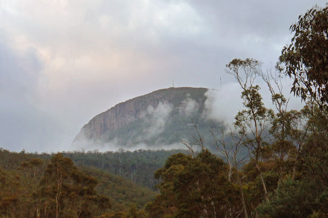
As we walked the last couple of kilometres the clouds on Kunanyi/Mt Wellington cleared to reveal the summit and its surrounding cliffs, called The Organ Pipes.
We surprised a wallaby on this section of track!
The entire walk was 12 kilometres long, and the maximum altitude we reached was 750 metres ASL. Here’s a Google Earth view of the whole walk (the red line):
Tags
If you enjoyed this blog post, you can find related posts under these headings:
Share this The Journey and the Destination post using your favourite social media:
Would you like to add something, or ask a question? Add a comment below (you can leave the 'Website' field blank):


