I've bushwalked on the Trevallyn Nature Recreation Area, near the Launceston CBD, many times while house-sitting here.
I thought that I’d pretty much covered all of it; however, I've realised recently that there is one bit of track there I may have never walked on. That track is the South Esk track, which runs along Cataract Gorge, above the South Esk River.
The Trevallyn Nature Recreation Area is adjacent to Cataract Gorge Reserve – which I have posted about before – it's just a little bit further out of town. I have often walked in both areas combined.
The South Esk track looked likely to be a nice walk with good views, so I’ve recently walked it. It's only a couple of kilometres each way, so I've extended it with some of the tracks that I've walked before to make a longer route.
The first part of my walk is through bushland from First Basin towards Deadman’s Knob, a hill that rises above the river. It's winter here in Tasmania, the rainy season, and we've had a bit of rain recently; so, while the track is some distance from the South Esk River, I can't actually see the river running through the gorge below me from this part of the walk, but I can hear the roar of the water rising up.
Visitors to Deadman's knob have created a stone circle from the rocks lying around on the summit of the hill:
It's a variation on the cairns that bushwalkers usually construct on the tops of mountain peaks.
An old weir
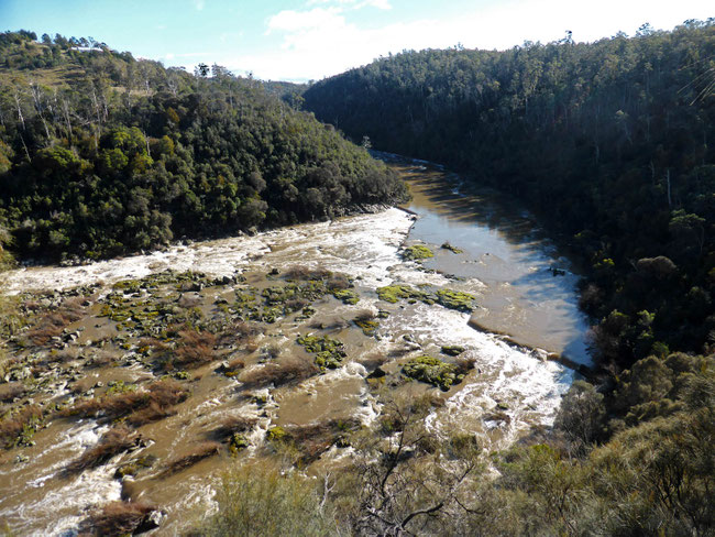
My first view of the South Esk River is from Deadman’s Hollow lookout.
You can see that there are the ruins of an old weir across the river.
I accidentally found out why this large weir was constructed. The South Esk track starts here at Deadman’s Hollow lookout. At the head of the South Esk track I noticed another formed path running off to the side, which I took out of curiosity. The path zigzagged down the side of the gorge to the water’s edge and ended at the northern end of the weir.
At the end of the path I found a channel and a penstock cut in to the cliff face, with a walkway into a tunnel disappearing into the cliff behind a locked gate. I'm guessing that this is all part of an earlier iteration of the hydroelectric schemes that have been built the river over the last 120 years.
The South Esk track
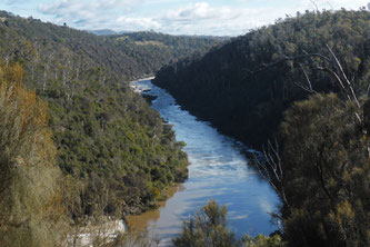
This is the reach of the river along which the South Esk track runs:
The track continued through pleasant bushland along the edge of the gorge, with lovely views of the river through the trees.
Trevallyn Dam
The South Esk track ends at the Trevallyn Dam, part of the current hydroelectric scheme on the South Esk River:
Water from Trevallyn dam flows down a tunnel to the hydroelectric generating station on the Tamar River at Trevallyn. As you can see, there's plenty of water now, so wholesale electricity prices should be down at the moment!
Duck Reach Power Station
My return journey took me past the disused Duck Reach Power Station.
The Duck Reach Power Station was irreparably damaged in a flood in 1969.
The rest of my walk was along Cataract Gorge, with views of the cliffs on the other side.
The walk
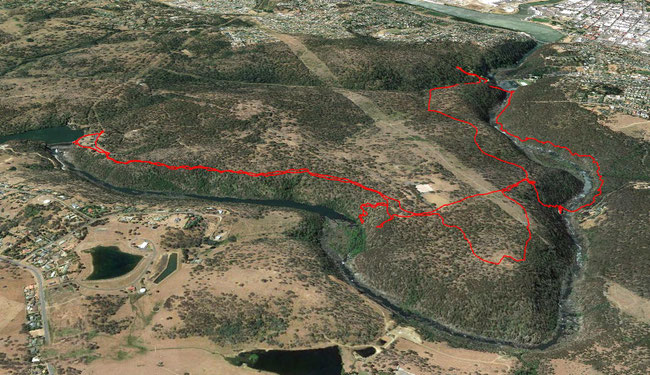
This walk was 12.5 kilometres long, with a total ascent of 765 metres. I parked at the carpark near the Gorge Café on the north side of first Basin, here.
This a Google Earth aerial view of my walk, which I captured on my phone using the Handy GPS app:
That’s Launceston CBD in the top-right hand corner of the picture.
If you want to try this walk, you can download a kml file to use in your GPS navigator or navigator app here.
Tags
If you enjoyed this blog post, you can find related posts under these headings:
Share this The Journey and the Destination post using your favourite social media:
Would you like to add something, or ask a question? Add a comment below (you can leave the 'Website' field blank):


John (Sunday, 15 August 2021 13:21)
The flood was in 1929 and the place was rebuilt.